
official data (JTWC Warning NR 014 + NASA EONET pointer)
JTWC upgrades Dujuan to a typhoon — 65-knot winds still south of Japan
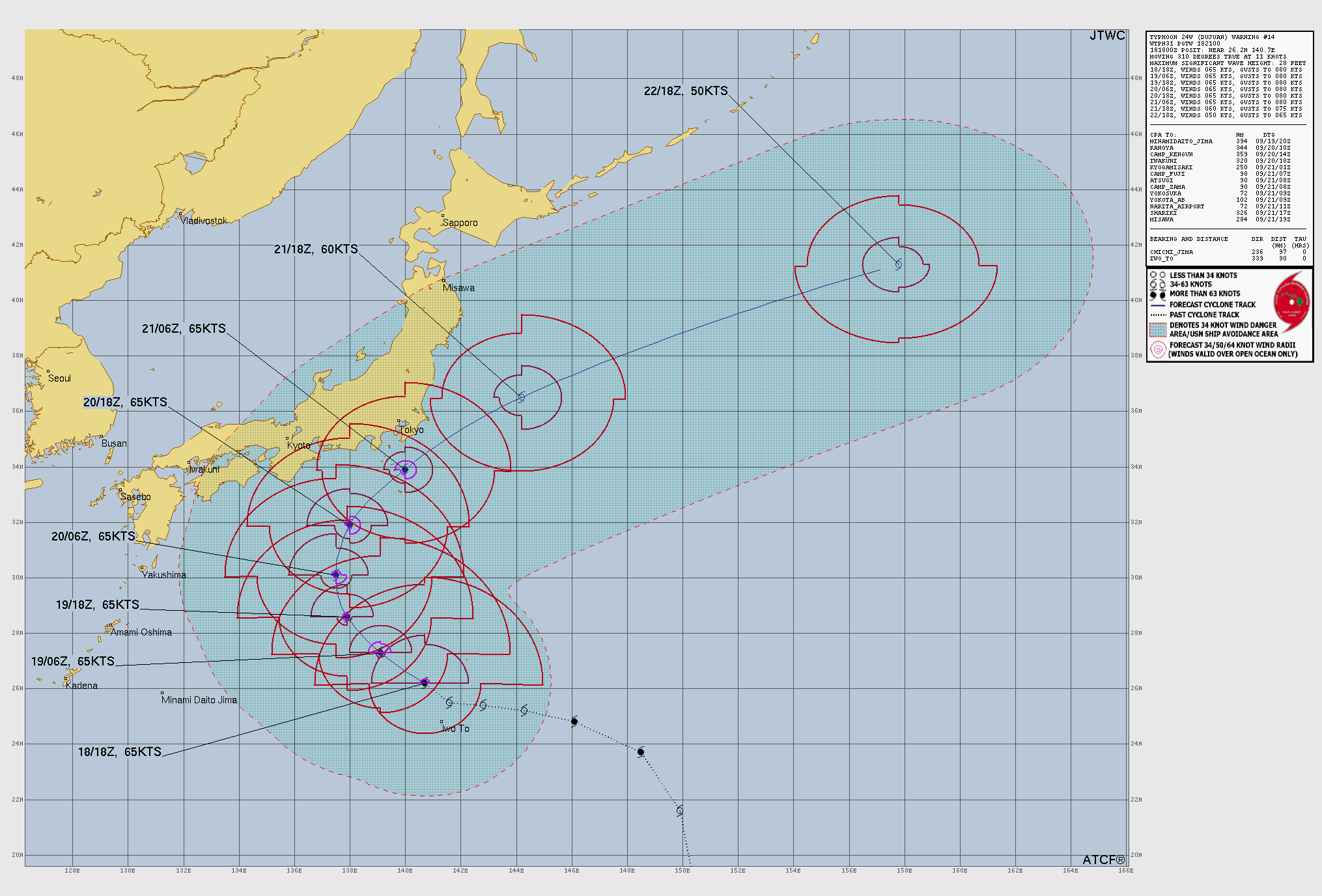
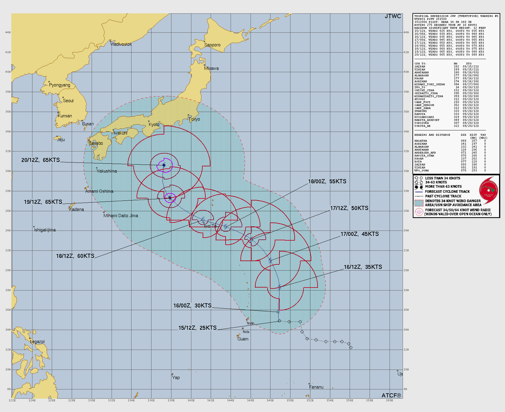
The U.S. military’s Joint Typhoon Warning Center just upgraded Tropical Storm 24W (Dujuan) to a typhoon — 65-knot sustained winds, still the only active tropical cyclone in the northwest Pacific, tracking northwest about 550 nautical miles south of Yokosuka.
Key facts
- Subject
- TYPHOON 24W (DUJUAN) WARNING NR 014 — UPGRADED FROM TROPICAL STORM 24W
- Active count
- 01 active tropical cyclone in Northwest Pac
- Warning position (181800Z)
- near 26.2N 140.7E · movement 310° at 11 kt
- Max sustained winds
- 065 kt, gusts 080 kt (1-minute average; radii over open water only)
- Min central pressure (181800Z)
- 977 mb · max significant wave height 28 ft
- Remarks position (182100Z)
- near 26.5N 140.3E · ~548 nm south of Yokosuka, Japan
- Forecast intensity (JTWC NR 014)
- 065 kt through 60h · 060 kt / becoming extratropical at 72h · 050 kt extratropical at 96h
- Live
- Intensity/track revisions → live HUD / next JTWC warning. Not inventing Japan landfall, JMA category, or damage totals.
The only storm in that whole ocean just got the typhoon stamp.
Desk reading of JTWC Warning NR 014
Note
The U.S. Joint Typhoon Warning Center upgraded Dujuan from a tropical storm to a typhoon on Friday — Warning number 014.
Sustained winds are now listed at 65 knots, with gusts to 80. The center puts the storm near 26.2 north, 140.7 east as of 1800 UTC, still the only active tropical cyclone in the northwest Pacific, and roughly 550 nautical miles south of Yokosuka, Japan.
JTWC’s own forecast holds those typhoon-strength winds for several days as the system tracks northwest, then north and northeast, before calling it “becoming extratropical” by about 72 hours and fully extratropical by 96 hours — well out into the open Pacific. Wave heights in the warning were stamped at 28 feet.
NASA’s EONET board still lists the same system as an open severe-storm event. Intensity and track can change with the next warning — see the live HUD, not this note, for later stamps.
Why it matters
The only storm in that whole ocean just got the typhoon stamp. Official forecast keeps it at typhoon strength for days while it slides along Japan’s southern approaches, then turns it extratropical far offshore. That is the meter — not a carnival Japan-landfall-tonight call. Watch the next JTWC warning; live meters stay on the HUD.
Sources
- Joint Typhoon Warning Center (JTWC)
- JTWC TCW product wp2426.tcw
- NASA EONET event EONET_24317 (Typhoon Dujuan)
Official data. Live values go to the HUD / source product.